

| Josephus: Temple | Aerial Photo -Temple Mount |
Warren's Survey Map -With descriptions |
Ophel Excavations -Ruins reveal the location |
Water Channels
and levels -Map and info |
Ancient Ophel Steps |
| Fort Antonia -On the highest hill |
Nehemiah Map -Map of City Wall |
Double Gate -Not Huldah Gate |
Southeast Corner -Who built it? |
Temple Platform -Original location |
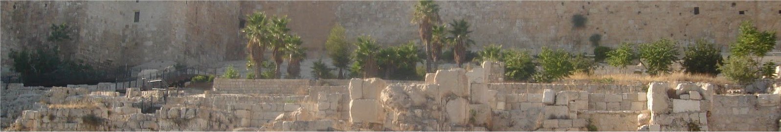
Wailing wall -A little history |
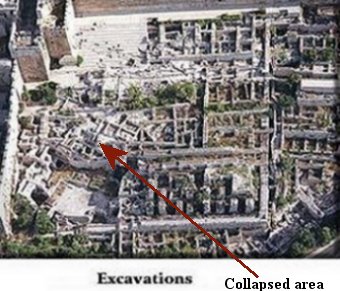
The collapsed and rotated mess in the middle of the ophel ruins has
not helped in identifying this area.
This section had an underground cistern/pool which collapsed at
least a 1000 years or so ago, most likely during an earthquake, perhps
the earthquake in the early 600 CE.
When the cistern collapsed the ruins fell in and rotated this whole
section.
 ................
In the below picture I adjusted this area in a paint program, which
enables us to see the original layout a little better.
 .............
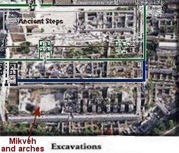
The arches have been renovated since they were first excavated, but
they were a real mystery. Some thought they were bath house
of some sort. However, I believe I have solved that mystery with
this location for the Temple. In the above photo Herod's south
gateis in blue on the left side of the photo. The ruins of are
located at an elevation above the arches. Many steps led up to
the double wide south gate from the road at the bottom of Ophel hill.
Large steps needed arches below that were built on bedrock to support
them. (Much like the arches of Robinsons' Arch.)

With my location for the Temple that is what these arches were for.

In the below photo I show both the steps and using a window to peer through, I show the arches below the steps.

Herod's south gate with steps and window looking into the Mikveh/bath on the right of the steps.
